Lake Erie

Stretching 241 miles wide, Lake Erie is known for its stunning beaches and incredible sunsets, making it a perfect getaway. Its shallow waters warm up quickly in the summer, offering ideal conditions for boating, swimming, and fishing. Plus, the lake's vibrant coastal towns provide endless fun with unique shops, restaurants, and attractions to explore. Learn more about Lake Erie and its history below.
The 11th Largest Lake In The World
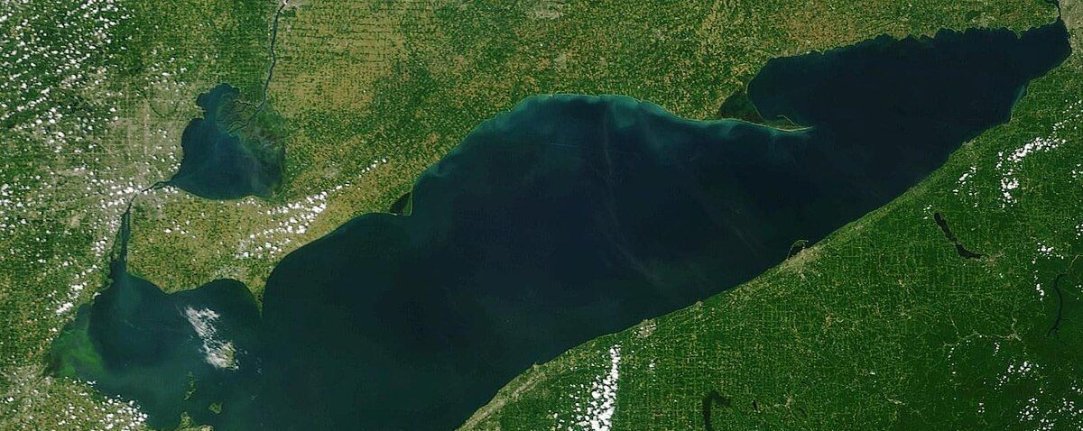
Lake Erie Facts
Lake Erie is the fourth largest lake of the five Great Lakes in North America and the eleventh-largest globally, It forms the boundary between Canada (Ontario) to the North and the United States (Michigan, Ohio, Pennsylvania, and New York) to the West, South, and East. It is the southernmost, shallowest, and smallest by volume of the Great Lakes and therefore also has the shortest average water residence time. At its deepest point Lake Erie is 210 feet deep. Situated on the International Boundary between Canada and the United States, Lake Erie's northern shore is the Canadian province of Ontario, specifically the Ontario Peninsula, with the U.S. states of Michigan, Ohio, Pennsylvania, and New York on its western, southern, and eastern shores. These jurisdictions divide the surface area of the lake with water boundaries. The lake was named by the Erie people, a Native American people who lived along its southern shore. The tribal name "erie" is a shortened form of the Iroquoian word erielhonan, meaning "long tail".
Situated below Lake Huron, Erie's primary inlet is the Detroit River. The main natural outflow from the lake is via the Niagara River, which provides hydroelectric power to Canada and the U.S. as it spins huge turbines near Niagara Falls at Lewiston, New York and Queenston, Ontario. . Some outflow occurs via the Welland Canal, part of the St. Lawrence Seaway, which diverts water for ship passages from Port Colborne, Ontario on Lake Erie, to St. Catharines on Lake Ontario, an elevation difference of 326 ft (99 m). Lake Erie's environmental health has been an ongoing concern for decades, with issues such as overfishing, pollution, algae blooms, and eutrophication generating headlines
LAKE ERIE QUICK STATS
- Area: 9,940 mi²
- Width: 57.17 mi
- Length: 241.1 mi
- Surface elevation: 569′
- 872 miles shoreline
- 90% of water from the upper Great Lakes via Detroit River
- More consumable fish than all other Great Lakes Combined
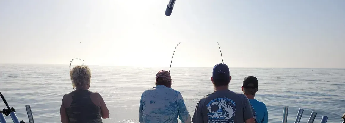
Lake Erie is home to one of the world's largest freshwater commercial fisheries. Lake Erie's fish populations are the most abundant of the Great Lakes, partially because of the lake's relatively mild temperatures and plentiful supply of plankton, which is the basic building block of the food chain. The lake's fish population accounts for an estimated 50% of all fish inhabiting the Great Lakes. The lake is "loaded with superstars" such as steelhead, walleye (American usage) or pickerel (Canadian usage),smallmouth bass, perch, as well as bass, trout, salmon, whitefish, smelt, and many others, The lake consists of a long list of well established introduced species.
Common non-indigenous fish species include the rainbow smelt, alewife, white perch and common carp. Non-native sport fish such as rainbow trout and brown trout are stocked specifically for anglers to catch. Attempts failed to stock coho salmon and its numbers are once again dwindling. Commercial landings are dominated by yellow perch and walleye, with substantial quantities of rainbow smelt and white bass also taken. Anglers target walleye and yellow perch, with some effort directed at rainbow trout. A variety of other species are taken in smaller quantities by both commercial and sport fleets.
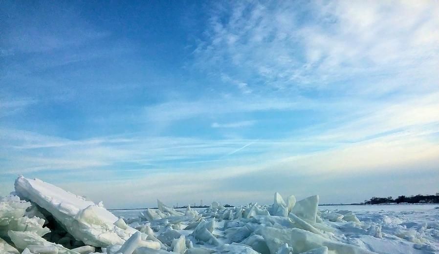
Estimates vary about the fishing market for the Great Lakes region. One estimate of the total market for fishing, including commercial as well as sport or recreational fishing, for all of the Great Lakes, was $4 billion annually, in 2007. A second estimate was that the fishing industry was valued at more than $7 billion. Commercial fishing is now predominantly based in Canadian communities, with a much smaller fishery—largely restricted to yellow perch—in Ohio. In winter when the lake freezes, many fishermen go out on the ice, cut holes, and fish. It is even possible to build bonfires on the ice. But venturing on Lake Erie ice can be dangerous.
Lake Erie Fishing
Like all of the Great Lakes, Lake Erie is basically a divot formed from a moving glacier and is relatively young — less than 4,000 years old — in its current configuration.
Several native peoples lived on lake's shores, including the Erie tribe and the Iroquois. Lake Erie was the last of the Great Lakes to be explored by Europeans. French explorer Louis Joliet "discovered" the lake in 1669.
Lake Erie Formation
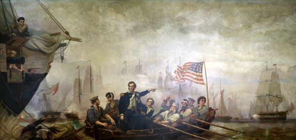
The lake played a pivotal role in the War of 1812. The Battle of Lake Erie took place off the north shore on Sept. 10, 1813. U.S. Navy ships defeated the British Navy, gained control of the lake and regained Detroit. The site of the battle is now officially known as the River Raisin National Battlefield Park.
As the battle began, Captain Oliver Hazard Perry hoisted his battle flag, emblazoned with the words, "Don't Give Up the Ship." After the British surrendered, Perry sent a message to General William Henry Harrison: "We have met the enemy and they are ours." About 934 Americans fought in this battle and only 33 survived.
The Battle of Lake Erie

By the 1960s, Lake Erie had become sort of a "poster child" for water pollution. Pollutants from factories, waste from city sewers, and fertilizer and pesticides from farms made their way to the lake, according to Cleveland Historical. As a result, levels of phosphorus and nitrogen increased, which led to algae blooms. The toxic algae caused "dead zones" by depleting the oxygen, and dead fish littered the shoreline. And in 1969, the Cuyahoga River, which flows through Cleveland, Ohio, caught fire.
The federal government responded to this situation by passing the Clean Water Act in 1972. The law tightened regulations on industrial dumping.
While the water quality of Lake Erie has much improved, the lake continues to be prone to algae blooms and still has dead zones.
Lake Erie Pollution
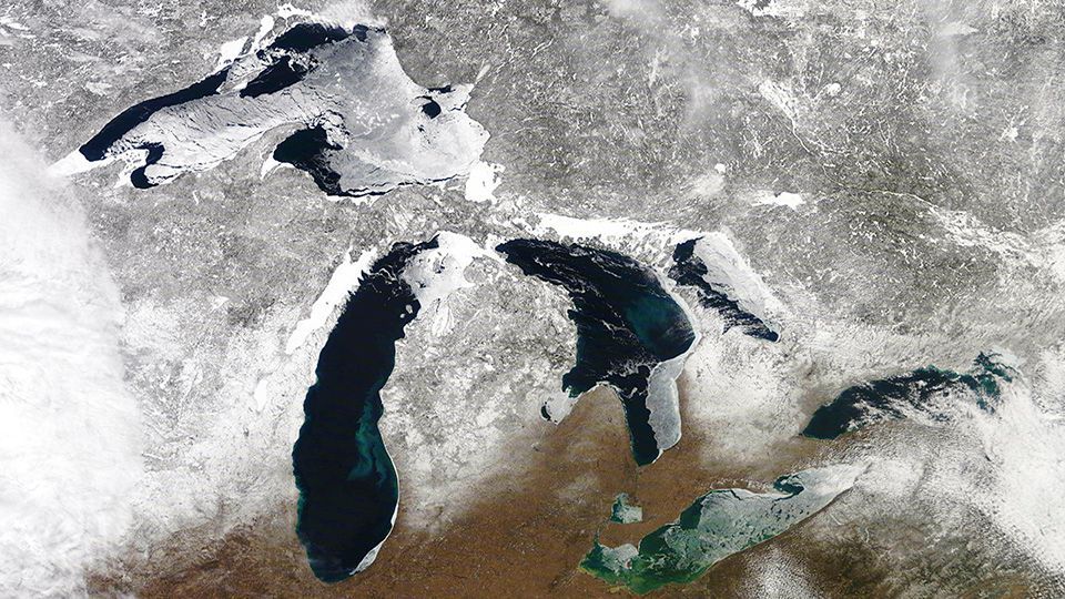
Due to its southernmost position, Lake Erie is the warmest of all of the Great Lakes. While temperatures have reached as high as 85 F (29 C), water temperatures are generally in the low 70s F (21 C to 24 C) during the summer months, making Lake Erie a popular recreational area.
During the winter, water temperatures reach freezing, and the lake freezes over more than the other Great Lakes because of its shallowness. Its average depth is 62 feet (19 m) and its maximum depth is 210 feet (64 m).
Water levels are 25 to 30 feet (7.6 to 9.1 m) in the lake's shallowest area, making it possible for strong winds to kick up fairly powerful waves in excess of 15' high
Lake-effect snow has a huge impact on the surrounding communities, including Buffalo, N.Y.
Lake Erie Weather

Lake Erie Islands tend to be located in the western side of the lake and total 31 in number (13 in Canada, 18 in the U.S.).
The island-village of Put-in-Bay on South Bass Island is a major tourism attraction. Kelleys Island has deep glacial grooves left in limestone. Pelee Island is the largest of Erie's islands, accessible by ferry from Leamington, Ontario and Sandusky, Ohio. The island has a "fragile and unique ecosystem" with plants rarely found in Canada, such as wild hyacinth, yellow horse gentian and prickly pear cactus, as well as two endangered snakes, the blue racer and the Lake Erie water snake. Songbirds migrate to Pelee in spring, and monarch butterflies stop over during the fall.
Lake Erie Islands
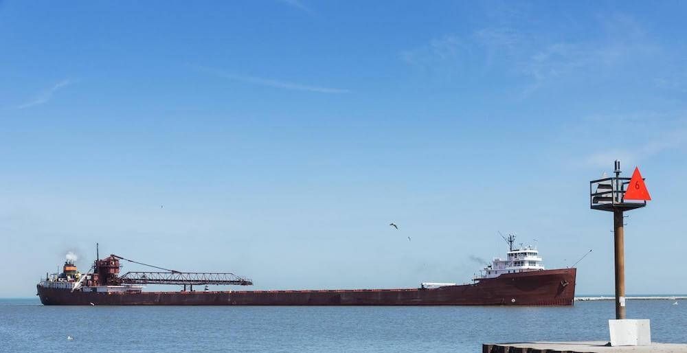
The lake has been a "bustling thoroughfare" for maritime vessels for centuries. Ships headed eastward can take the Well and Canal and a series of eight locks descending 326 feet (99 m) to Lake Ontario which takes about 12 hours. Generally there is heavy traffic on the lake except during the winter months from January through March when ice prevents vessels from traveling safely.
The ship traffic in Lake Erie being the highest among the Great Lakes and roughest of the lakes has led to it having the highest number of known shipwrecks in the Great Lakes. The Port of Cleveland generated over $350 million and over 15 million tons of cargo in a recent year.
Lake Erie Shipping
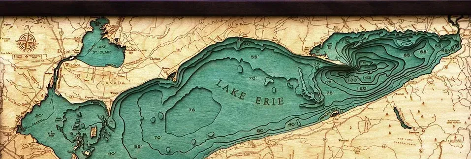
The Western Basin of Lake Erie is the shallow flat basin that comprises the western third of the lake. Even with average depths of less than 25’ this part of the lake contains world-famous walleye fishing grounds with numerous charter fishing boats operating out of the U.S. states of Michigan and Ohio and the Canadian province of Ontario.
The western basin, comprising about one-fifth of the lake, is very shallow with an average depth of 7.4 meters (24 feet) and a maximum depth of 19 meters (62 feet). Western Lake Erie has 32% of Lake Erie’s shoreline, 13% of the Lake Erie area and 5% of Lake Erie’s volume. Western Lake Erie is Lake Erie’s primary spawning waters. The Western Basin of Lake Erie turns over every 30 – 45 days compared to 2.6 years on average for all of Lake Erie. This means that if nutrient sources are reduced, Lake Erie algae should be reduced quickly.
The Western Basin
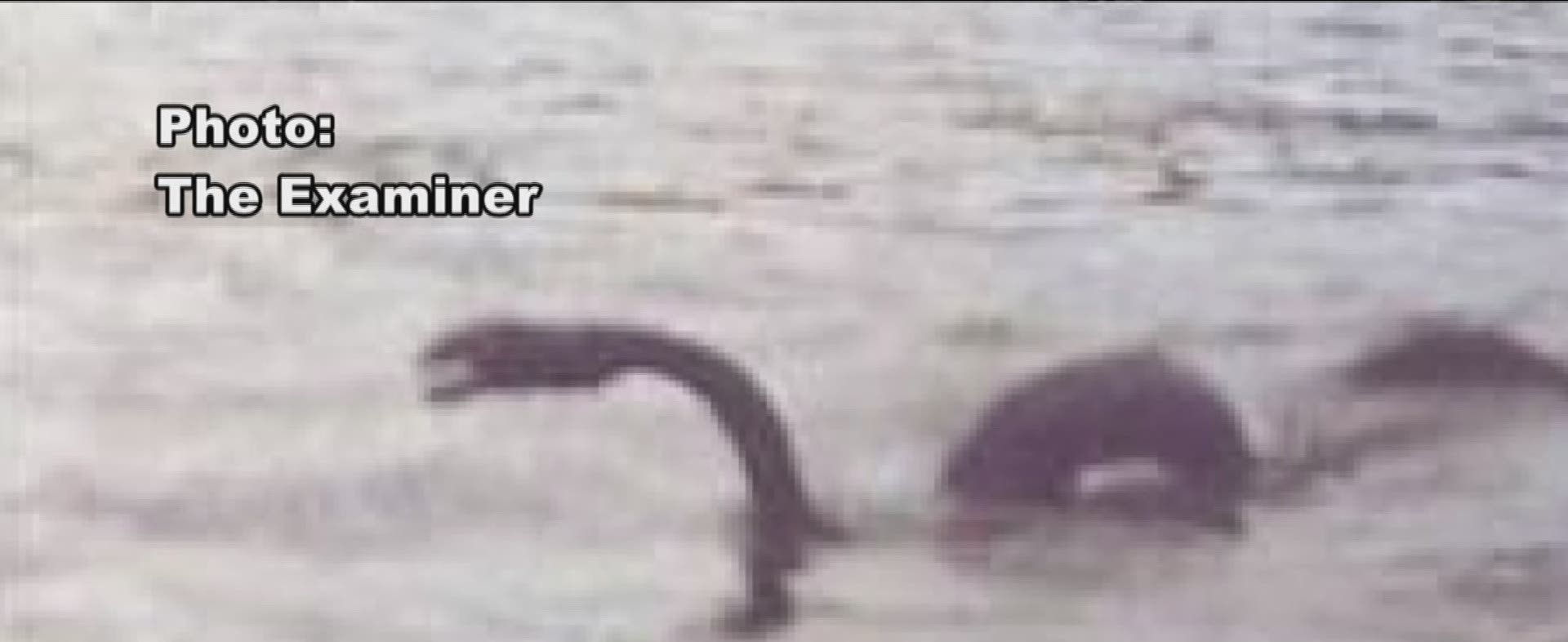
"Bessie" is a name given to an alleged lake monster in Lake Erie. The first recorded sighting of Bessie occurred in 1793, and more sightings have occurred intermittently and in greater frequency in the last three decades. Bessie is reported to be snake-like and 9 to 12 meters (30 to 40 feet) long, at least 30 centimeters (1 foot) in diameter, with a grayish color.
There is a beer named after the Lake Erie Monster as well as a hockey team
The Lake Erie Monster "Bessie"

When one thinks about Lake Erie visions of boating and fishing and other recreational opportunities are often conjured up. But for a bird-watcher, the lake shores and open waters provide a spectacle like no other in the entire Great Lakes. Waterfowl galore pack marshes and the open lake waters, and interesting marsh birds breed in coastal wetlands. Winter brings hardy northern ducks, gulls, and raptors, there is never a dull season.
The Lake Erie Marsh Region is recognized as globally important for migratory birds as millions of migratory songbirds, shorebirds, and waterfowl stop here to feed and rest every spring and fall during their long-distance migrations. Lake Erie shorelines and attendant inland natural areas are also home to a large number of permanent residents. Nearly 400 bird species have been documented in this region. Visiting birders travel to this region of northwest Ohio to observe and enjoy this spectacle, bringing millions of dollars to local lakeshore communities.
Why is Lake Erie such an attractive and important place for birds? Lake Erie represents a barrier to most migrating passerines (perching birds) and raptors. Many birds are reluctant to cross open water when the opposite shoreline cannot be seen, which results in major concentrations along the southwestern shore of Lake Erie in the spring, unparalleled in the Midwest. The opposite phenomenon occurs on the north shore of Lake Erie in autumn, making public areas like Long Point, Point Peele, Holiday Beach and every private piece of habitat in between extremely valuable for resting and feeding areas for birds in migration.
With the exception of the Gulf coast, no other region of eastern North America can demonstrate concentrations of avian migrants like Lake Erie’s coastline. Important migratory pathways and habitat along Great Lakes shorelines have been identified at more than 60 sites; and 95% of the waterfowl counted on a recent Ohio Division of Wildlife aerial survey occurs in the Lake Erie marsh region. The landscape along Lake Erie has been dramatically altered from pre-settlement conditions yet the region remains important for birds to rest and feed so they can continue their migration in good physiological condition. Unfortunately, habitat loss in the region continues, potentially jeopardizing the ability of birds to maintain sufficient condition to successfully complete their migration. Consequently, it is critical and urgent to define, protect, restore, and better manage migratory bird stopover sites in the western Lake Erie basin.
